CN

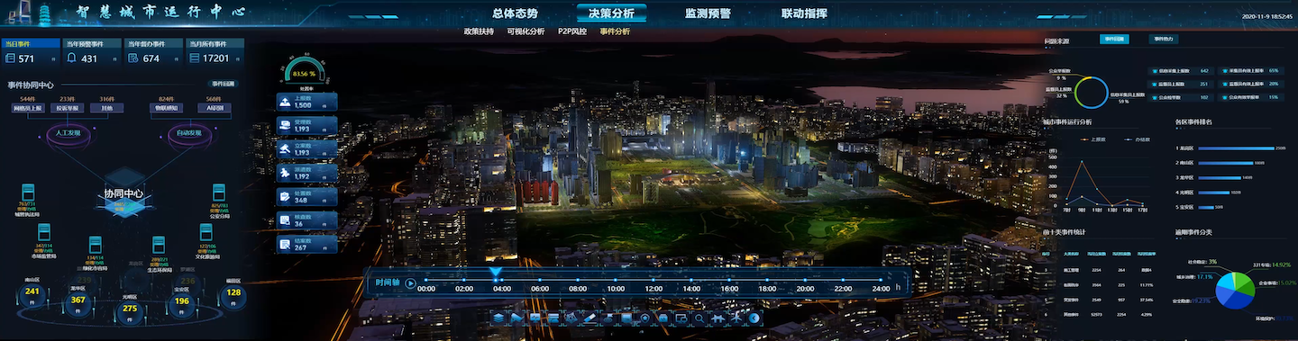
With the independent controllable cloud rendering and massive data carrying technology as the core, the Smart City IOC supports multi-level visual rendering such as 3D entity, big data, business logic and application scenarios to truly display various scenes such as urban appearance, natural environment, urban real-time traffic, etc., supports the multi-terminal integration, and creates core functions such as dynamic supervision, simulation deduction, intelligent intervention, virtual-real interaction, etc., meeting the demands of different smart city businesses and application scenarios.
 Spatio-temporal System of Full Data Fusion
The urban spatio-temporal data platform system is constructed on the basis of the massive data from multiple sources and types in the city to serve and manage the whole life cycle of multi-source heterogeneous data and provide data support for the city's whole-area perception in the way of standardized business flow.
 Visual Presentation of Full Element Expression
Based on all the city data, the full element twinning of the landscape scenes such as terrain, buildings and urban governance scenes such as population and industry is visualized, to restore the city from every aspects, from macroscopic to microscopic, from outdoor to indoor, with different granularity and different precision.
 Real-time Linkage of All IOT Perception
The holographic perception and accurate mapping of public facilities, urban operation, urban appearance and order are realized with the spatio-temporal data platform as the link, based on various IOT devices. And the reverse control and intelligent intervention on smart city are realized through high-visibility deduction and prediction.
 Multi-terminal Integrated Linkage
The multi-terminal integrated linkage helps to construct a double fusion closed loop of virtual and real interaction and control across networks, screens, systems, devices and regions to realize the core functions of smart city full scene, such as intelligent identification, precise mapping, trend prediction and intelligent intervention.
 Urban Governance
The urban governance system of "one screen and one network" is constructed with grid basic data, linkage center system data and the data of key places, key supervisors, public sentiment and opinion to realize the whole process perception and full closed-loop supervision of local governance, and to support the refined urban governance.
 Public Safety
Public safety risk data in relation to urban public health, social security, accident and disaster, natural disaster, etc., are collected to establish urban safety risk distribution map, to manage from the source, to improve risk prevention and control capacity, and to find out the key points of safety management and control.
 Linkage Command
The command center and mobile field end are connected on the basis of integrated communication, to build an integrated linkage system with visibility, accessibility and dispatch ability, improve urban management level, maintain social security and stability and apply to daily major activity support and command and dispatching under emergency conditions.
 Ecological Environment
Government affairs data in relation with IOT monitoring, complaints, reports, administrative punishment can be accessed in real time, and the real-time monitoring and visual analysis on air quality, water quality, agroforestry soil, natural disasters and other elements, are conducted to realize environmental supervision visualization and scientific environmental decision-making, and to assist managers to comprehensively monitor and evaluate environmental quality.
 Government Affairs Service
Monitoring, analysis and dispatching are carried out in terms of channel and business handling, to conduct visual real-time supervision over the whole life cycle of government affairs service, aiming to timely help managers to find and dispose the demands of natural persons and legal persons, and assist in process optimization, decision-making and the improvement of government affairs service level by creating government affairs service dashboard.
 Cloud Net Platform
Cloud Net Platform fully integrates the business system of government departments, builds five centers of infrastructure, data resources, sharing and opening, technical support and fusion application, promotes the fusion application of government affairs big data, and realizes the fusion monitoring of application system, cloud resource consumption and network coverage.
There are more than 50 relevant commission bureaus and over 100 business systems in related to multiple business fields and multiple types of business data in the jurisdiction area, providing data application scenarios with full business dimensions for urban management. Meanwhile, in consideration of local climate characteristics, a linkage emergency command system is constructed to provide information support for natural disaster prevention for many times.
Singapore office: 120 Robinson Road #13-01 Singapore 068913
Office Address: Room 2110, Unit 2, Building 9, Tianfu New Valley, Wuhou District, Chengdu,Sichuan Province
Office Address:Room 1504, Unit 5, Building 11, Guojinhua Mansion, Weiyang District, Xi'an , Shanxi Province
Office Address: Room 1701, Zifang Building, 3333 Shuanglong Avenue, Jiangning District, Nanjing,Jiangsu Province