CN
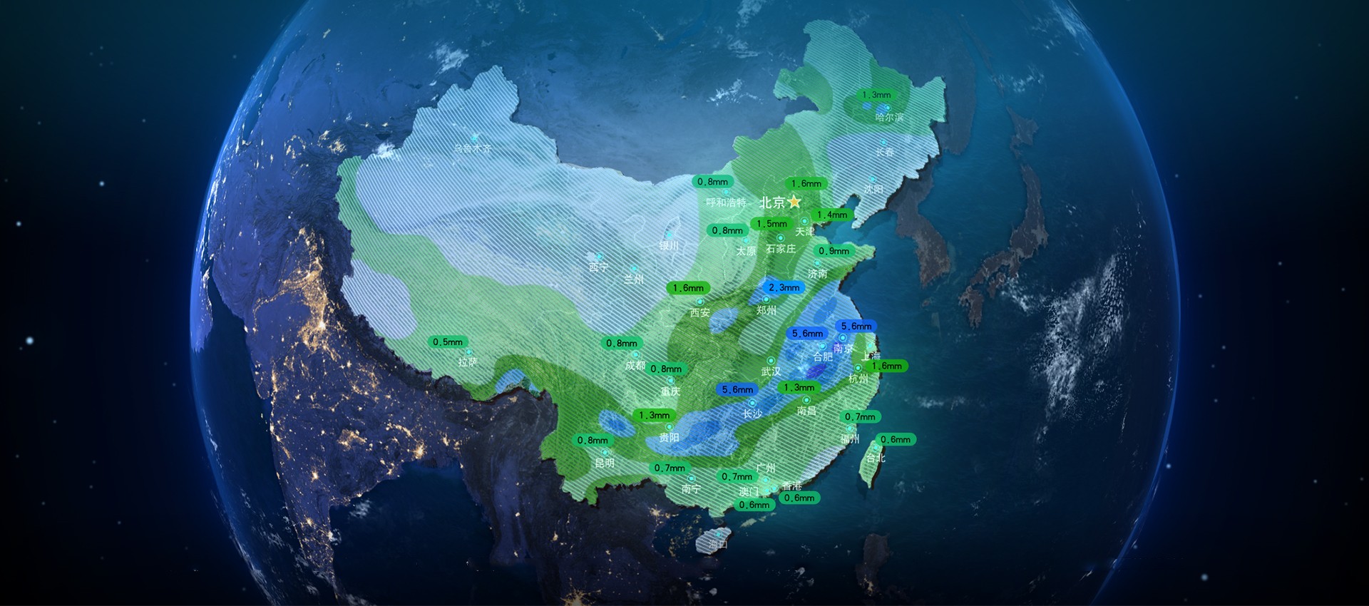
Based on geographic scene data, all the data related with the business system of meteorological management department, wind force and direction, visibility, rainfall, intensive convection, temperature, typhoon, etc., are integrated for real-time monitoring and visual presentation, assisting managers to comprehensively master meteorological conditions, realizing accurate meteorological prediction, real-time response within one screen
 Deep Integration of Business and Visualization
Meteorological information is integrated with businesses like port operation standards, and obscure meteorological language is expressed in a user-understandable way, to improve the efficiency of safe operation and dispatching.
 Precise Prediction of Weather Disasters
Multi-source heterogeneous meteorological data are classified and presented according to different topics, aiming to accurately analyze and forecast meteorological disaster development trend and then to provide data support for disaster prevention by relevant departments.
 Strengthening Disaster Prevention and Reduction
Various emergency resources are integrated in combination of the full-element monitoring data and multi-dimensional data analysis results, to improve the efficiency of dealing with emergencies and minimize the disaster impact.
 Real-time Weather Warning and Forecast
The professional algorithm model is adopted to conduct the real-time early warning and forecast of marine weather risk level, and the optimization of port dispatching and the safe production are realized in combination of the dynamic ship trajectory and port loading and unloading dispatching plan.
 Weather Situational Perception
Meteorological observation, Internet of Things, Internet, artificial intelligence and digital twin are integrated to realize the situation perception of the whole process of meteorological monitoring, management and incident disposal, and to assist decision-making.
 Spatio-temporal Weather Monitoring
All-day weather conditions of ground, high-altitude and ocean are monitored in real-time, to conduct visual early warning of severe weather, abnormal phenomena and weather disasters, and to improve the refinement level of early warning by management departments.
 Emergency Linkage Command
The integration of multi-department data and the linkage of multiple systems are supported to realize linkage command and dynamic deduction such as emergency deployment, resource distribution, action route and management of key areas, and to strengthen the capacity of dealing with sudden weather disasters.
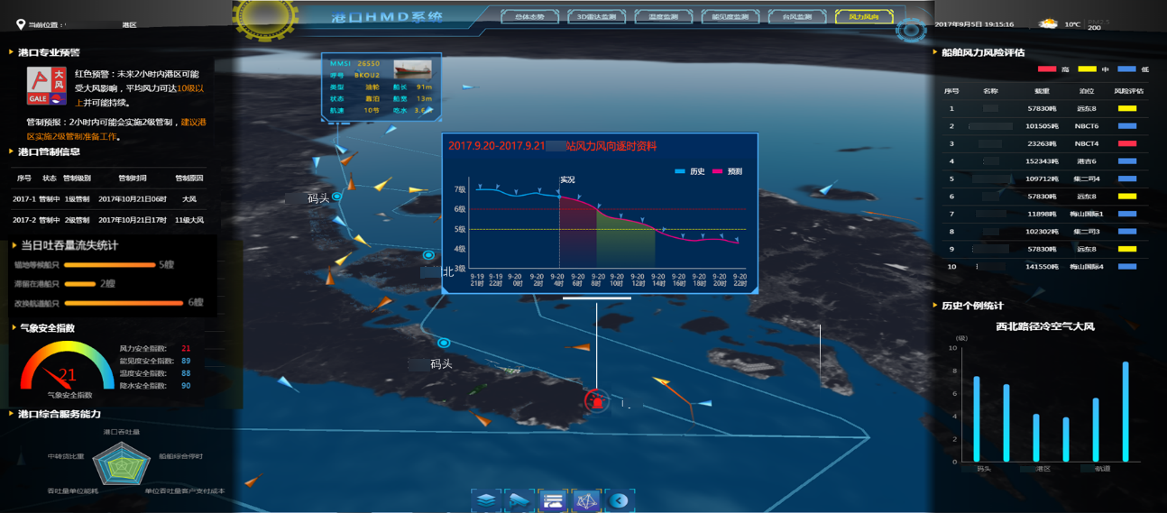
The platform provides professional meteorological early warning and decision-making products for port management and production companies, translates and presents professional meteorological data and early warning results in the way of 3D visualization, so that non-meteorological departments such as ports can intuitively and accurately master the weather conditions of ports and provide scientific basis for production, operation and dispatching of ports.
Singapore office: 120 Robinson Road #13-01 Singapore 068913
Office Address: Room 2110, Unit 2, Building 9, Tianfu New Valley, Wuhou District, Chengdu,Sichuan Province
Office Address:Room 1504, Unit 5, Building 11, Guojinhua Mansion, Weiyang District, Xi'an , Shanxi Province
Office Address: Room 1701, Zifang Building, 3333 Shuanglong Avenue, Jiangning District, Nanjing,Jiangsu Province